Monday, September 15, 2014

Baker Natural Area

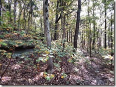
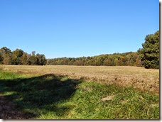
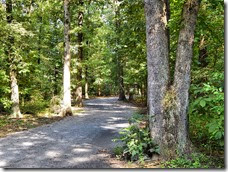
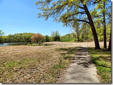
The Baker Natural Area consists of sixty-six acres within the city limits of Russellville, Kentucky. The landscape is quite diverse and contains open prairie, limestone barrens, sinkholes, forestland, and a small wetland area. Two thirds of the sixty-six acres is woodland and habitat for migratory birds and home to deer, wild turkey and small game.

The site has not been intensively farmed for more than twenty years and much of the native flora and fauna has returned to the landscape. A biological review has identified a total of three hundred seventy-seven plant species on the property. Five of these plants were listed in 2004 by the Kentucky Nature Preserves Commission as of special concern in Kentucky. These species include Purple Prairie Clover, Carolina Larkspur, Hairy Fimbry, Inland Muhly, and also Tansy Rosinweed.
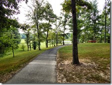
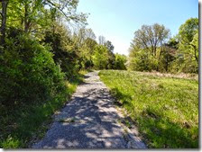
There are about two miles of walking trails with benches for use by the visitor. There is also a bird  watching shelter with other study shelters on the property. Study can be conducted for aquatic wildlife also. The trail is easy to walk and the benefits to the public are many. School children on field nature study trips or the average walker and hiker can enjoy this area for many years to come.

Logan County Glade

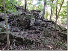
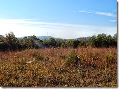
Logan County Glade State Nature Preserve is perched on the south-facing slopes of a knob within the city limits of Russellville. It is one of the best examples of a limestone slope glade community found in Kentucky. Limestone glades are naturally open areas with scattered ledges and slabs of limestone outcropping at or near the surface. The soil is thin and the hot, dry conditions on the south-facing openings leave exposed trees sparse and stunted. These seemingly adverse conditions offer a special refuge for many prairie and glade plants.

Logan County Glade protects several species that are considered state and globally threatened or endangered. These include the Fame Flower, for which this is one of only two known occurrences in the state; the Carolina Larkspur, a tall, pale, whitish-purple flower similar in shape to the garden variety; a nondescript shrub commonly known as Upland Privet; and the Glade Violet. Many prairie species are found here because rocky soils and steep slopes have made Logan County Glade unsuitable for agriculture.

There are a number of cultural features that hint at the area’s past uses. The limestone fence along the  preserve’s southern border was built before the Civil War. The trail along the base of the knob was an old county road. In the early twentieth century, the John Dockins family farmed the top of the knob for corn and tobacco. In 1960 the land was sold to the county to build a hospital. Other than constructing a radio tower and a small building that housed communication equipment for the hospital, the glade and knob were generally left undisturbed by the county.

The preserve was officially opened to the public in 1991 after local Boy Scouts from troops 303 and 58 helped to clear cedars and other trees from one of the glades and built a trail through the property. The half-mile loop leads hikers to one of the glades, through the woods to the top of the knob and back to the trailhead. The preserve is open to hiking, nature study and photography from sunrise to sunset. Picnicking, camping, hunting, pets, bicycles and ATV’s are prohibited.

Big Rivers WMA

The Kentucky Division of Forestry and the Kentucky Department of Fish and Wildlife Resources have jointly acquired nearly 2,500 acres at the confluence of the Ohio and Tradewater Rivers. The property is the state’s newest Wildlife Management Area and State Forest. The site near Sturgis is a portion of one of the largest private landholdings in Kentucky; known locally as the Alcoa Property, or more recently as the Kimball Property.

“It’s the gem on the Ohio River,” state Senator Dorsey Ridley said of the expansive area. “It’s a historic area. Lewis and Clark camped at the mouth of the Tradewater on their trip to the Pacific Ocean in the early 1800s.”

Big Rivers WMA and State Forest provides public recreational opportunities for hunting, fishing, hiking, canoeing, and wildlife viewing. The property will also be managed to provide watershed and water quality protection; protection and recovery of endangered, threatened and rare species; preservation of existing cultural and geological treasures and a sustainable forest. It will be permanently protected from development and agricultural conversion.

This area is described as having steep to very steep upland hardwood forests, flat to rolling bottomland hardwood forest, and agricultural lands bordered by the Ohio River to the west and the Tradewater River to the south. The online map of the site depicts the trails; however, notation of the distances is lacking. Upon hiking the area and studying the map, I would estimate four to five miles of trails. Many of these trails are more like access roads for those managing the property and one trail appears to be an old abandoned railroad bed.

Jackson Purchase Medical CTR Trail

Mayfield Hospital Trail 011 - LIKE The following information was retrieved from the Jackson Purchase Medical Center website concerning this unique hospital located in Mayfield, Kentucky: “Soliant Health, a leading specialty healthcare staffing provider and part of Adecco Group, is proud to announce the top 20 Most Beautiful Hospitals in America. Jackson Purchase Medical Center came in at number fifteen.”

Mayfield Hospital Trail 005 - LIKE “The design of Jackson Purchase Medical Center provides our patients, visitors and staff with a comfortable, pleasant environment. We believe that such an environment improves their overall experience and patient outcomes,” said Fred Pelle, C.E.O. Jackson Purchase Medical Center combines state-of-the-art equipment, advanced technologies, and a nurturing, friendly environment to merge the science of medicine with the art of healing” (JPMC Website).Mayfield Hospital Trail 009 - LIKE

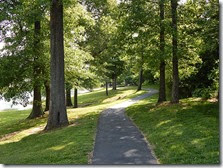
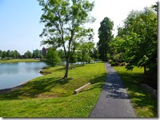
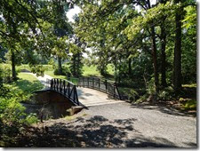
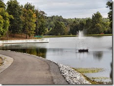
Perhaps one of the attractions making the Jackson Purchase Medical Center the fifteenth most beautiful hospital in America is the addition of the Fitness Trail out front. This trail is an estimated one mile in length, making a picturesque loop around a small lake with scenic landscaping. This trail can be done as a side trip after hiking the much longer Kess Creek Park Trail in Mayfield. Hiking the Kess Creek trail is still on my “to do list.”

Paducah Greenway

Paducah, originally known as Pekin, was settled around 1815. Settlers were attracted to the community due to its location at the confluence of the Ohio and Tennessee Rivers. In 1827, William Clark (of the Lewis and Clark expedition) arrived in Pekin with a title deed to the land, which was issued by the United States Supreme Court. The town was platted out and named in honor of the largest nation of Native Americans that ever roamed North America, the Padouca Indians. The community was incorporated in 1830.

The Clyde F. Boyles Greenway Trail currently has two completed sections with the third phase under construction, and an additional phase planned. The Paducah Greenway is funded in part thanks to income from an endowment from the Boyles estate. Lanelle Boyles, who died December 31, 2005, bequeathed a portion of the estate to the City of Paducah to be used for walking and biking trails in memory of her husband, Clyde F. Boyles. The endowment is managed by the Community Foundation of West Kentucky, Inc.

The trail is open to non-motorized traffic from dawn to dusk. Once completed, the Paducah Greenway will stretch five and one-half miles linking residential neighborhoods with numerous city parks and lead downtown to the bustling and beautiful riverfront. The Greenway will link the following four parks when completed: Perkins Creek Nature Preserve, Stuart Nelson Park, Noble Park, and Schultz Park.

Mike Miller Park Trail

After approximately four and one half years of planning, designing and construction, Marshall County’s first full amenities park, Mike Miller County Park, opened to the public in September 2000. Before the park came to be, the Fiscal Court appointed a five-member park board to assess the recreation facilities within the county and the cities of Benton, Calvert City, Hardin and also the two state parks in the county.

The Park Board held a series of public meetings to determine peoples’ desires for additional recreational opportunities and traveled to other parks with outstanding facilities in the state of Kentucky and surrounding states. Armed with the information they collected, the board began a search for property. The perfect property would be centrally located and large enough for the development of recreational facilities, but not an excessive expenditure.

The Park Board recommended the purchase of an eighty-acre site in the community of Draffenville, located on U.S. Highway 68 West, near the interchange of the Purchase Parkway. In 1997, the county purchased the property. The Park Board then commissioned Brandstetler-Carroll of Louisville, Kentucky for a master plan of the park’s development. Construction began in the winter of 1998 and approximately two and one half years later, the park was opened for public use. 

Park facilities include an 18-Hole Disc Golf Course, Soccer fields, Baseball Fields, Batting Cages, Basketball Courts, Tennis Courts, Sand Volleyball Court, Playgrounds, Five-acre Stocked Fishing Lake, Pavilions and Restrooms; and last but not least, a two-mile long Walking Trail with inclines and flats.

Kenlake Golf Trail

The Commonwealth of Kentucky began negotiations with the Tennessee Valley Authority in 1946 to lease a portion of land known as Aurora Landing. The land was situated on the western shore of Kentucky Lake near the Eggner’s Ferry Bridge. This leased land would be used as a state park dedicated to recreation.

The Tennessee Valley Authority leased an initial 1,146 acres to Kentucky. After the land transfer was officially completed on March 13, 1948, the new park at Aurora Landing was named Kentucky Lake State Park and joined the commonwealth’s state parks system. By the 1970’s, the name of the park was shortened to “Kenlake State Park.”

In 2013 the Bill Hamrick Memorial Golf Course at Kenlake State Park was permanently closed. Gil Lawson, spokesperson for the Kentucky Department of Parks, said there were a number of factors leading up to the eventual closing of the nine-hole course, including its reduced amount of play, its location in comparison to other available courses and pending reductions to park budgets.

Lawson said, however, the land would not be wasted, as the department is actively searching for something to replace the course. “We are looking at other outdoor uses for the facility,” Lawson said. “We would like to make it something to use” (Murray Ledger and Times). Upon speaking with someone at the front desk of the lodge, I was informed that the trail is open for biking and hiking. I estimate there to be at least two miles of trail.

North Paved Trail

The North Welcome Station is the gateway to the Land Between The Lakes and serves as a mini visitor center. You will find regional information, maps, brochures, snacks, and restrooms. The North Welcome Station serves as the main access point to numerous trail systems including the Canal Loop Trail, the North/South Trail; and also the North Paved Trail, which can be hiked all the way to the Hillman Ferry Campground by connecting with an unmarked trail system which will be noted below.

The North Paved Trail runs parallel to The Trace for an estimated two miles heading south through some wooded areas, past open fields, behind the Nickell Cemetery, and officially terminates at Road # 110. If you walk about one quarter mile west on Road # 110, you will pick up the unmarked Hillman Ferry Walking and Biking Trail located to the left of the road and accessed via a twenty foot long gravel trail. I include this additional hike, which is an estimated mile in length, as part of the North Paved Trail.

Administration Trail

LBL Central Trail 066 The Golden Pond Visitor Center serves as the information hub at Land Between The Lakes National Recreation Area. Visitors will find brochures, recreation maps, trail maps, state maps, restrooms, gift shop, children’s play area, a pavilion, trail heads and more.

An exhibit room of historic photographs and interpretive messages explains the rich heritage of the land and the people who lived “between the rivers.” The exhibit also delves into the construction of the dams  on the Tennessee and Cumberland Rivers with the eventual forming of Land Between The Lakes.

Visitors will also find Golden Pond as a great place to relax, picnic, and teach your children how to fish. For a small fee, visitors can see a show at the Planetarium on topics that include space exploration, planets, and the night sky. An Observatory sits out back which hosts free Star Parties at dusk from Memorial Day to Labor Day.

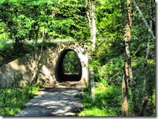
The Administration Trail can be found by hiking the Central Hardwoods Scenic Trail east. After walking a few hundred yards from the Visitor Center you will come to a “Y” in the trail. The Central Hardwoods Scenic Trail goes to the left, and  the “unmarked” Administration Trail goes to the right and through a tunnel/underpass.

This trail is an estimated one and one-half miles, making an out-and-back trip around three miles. The trail loops behind the administration office, goes behind the employee housing, and then continues on to the grounds maintenance buildings. There used to be published maps for the Administration Trail, but they are no longer available and the trail is no longer publicized.