Tuesday, September 25, 2012

Anderson Woodland Trail

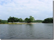
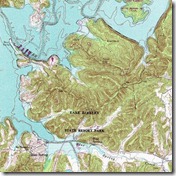
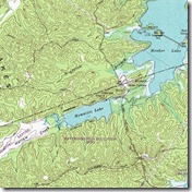
Homeplace, Kuttawa, LBL 077 The Anderson Woodland Trail can be accessed at an Army Corps of Engineers recreation facility found in historic old Kuttawa. The website “Recreation.Gov” describes this location as follows: “Old Kuttawa Recreation Area is on the northern shores of Lake Barkley, near the narrow canal linking it to Kentucky Lake. Together, these two reservoirs combine to create one of the greatest freshwater recreation areas in the country. Take pleasure in a day of picnicking or soak up the sun at the swimming beach; either way, old Kuttawa provides an ideal setting to enjoy nature at its best.”

The “National Recreation Trails” website describes the amenities that can Homeplace, Kuttawa, LBL 075be utilized at the time of your  walk along the Anderson Woodland Trail: “There are several picnic tables and grills along the trail for you to enjoy a small cookout or picnic. Adjacent to the trail is the Old Kuttawa Recreation Area, consisting of a public swimming area, swings, playground equipment, horse shoe pits, volleyball court, two restroom buildings, along with additional picnicking areas. The recreation area also offers two picnic shelters that may be reserved.”
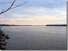
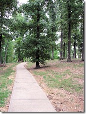
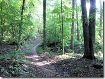
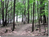
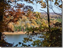
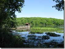
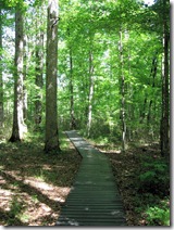
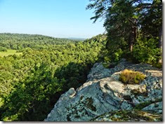
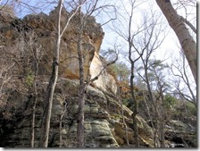
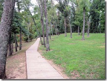
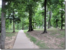
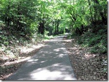
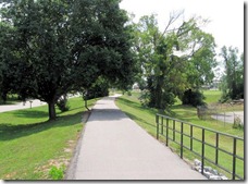
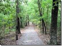
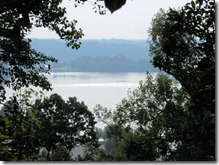
Homeplace, Kuttawa, LBL 064The Anderson Woodland Trail is one-third of a mile in length. It is a concrete trail and handicapped  accessible; and it has a change in elevation of about fifty feet. The path “is a short scenic trail, accessible and completely shaded. It reveals some of Lake Barkley’s most scenic views. It consists of one main loop with a short walkway leading to an overlook. You can use the overlook to view the Kentucky State Penitentiary, also known as the Castle on the Cumberland; or just relax for a moment and enjoy the refreshing breeze off the lake” (National Recreation Trails).

The “Reserve America” website states, “The half-mile Anderson Woodland Trail is an enjoyable footpath for birding and viewing the great tall trees of the region.” If you are looking for an extensive hike, however, this is not tHomeplace, Kuttawa, LBL 067he place. There is an access to the two-mile long Kuttawa Nature Trail located adjacent to the entrance of the Old Kuttawa Recreation Area; and I would recommend combining these two trails if you are looking to add some mileage. Afterward, you may wish to check out historic Kuttawa. You will come away from a day of hiking and sightseeing feeling very relaxed. Please be respectful of this public park and walking trail, and remember to “take only pictures” and “leave only footprints.”
Thursday, September 20, 2012

Cadiz Railroad Trail

Cadiz Rail Trail 053 The Cadiz Railroad was completed just after the turn of the twentieth century. The railroad was a spur off the Illinois Central Gulf Railroad in nearby Gracey, Kentucky; however, the line was abandoned around 1990. Since then, the tracks have been removed from Gracey to Cadiz, and all that now remains is the old Cadiz Railroad locomotive and tracks just west of Interstate 24 on U.S. Highway 68. The Illinois Central Gulf Railroad still passes through the northeastern part of Trigg County; however, it does not service Cadiz.

The Cadiz Railroad was not a vast trans-continental network, but a small railroad company that operated over 10.33 miles of track between Cadiz and Gracey. Across the tobacco fields and grazing lands, Gracey is Cadiz Rail Trail 035 no more than eight miles from the Trigg county seat; but back in 1901 when the line was organized, a company had to possess more than ten miles of track to be classified officially as a railroad. Therefore, William C. White, the founder, constructed two extra miles of curves to push the line over the ten-mile-long minimum. He didn’t want anyone to say that Cadiz didn’t have a railroad.

The Cadiz Railroad made its last run in 1988. Stanley White, the grandson of the railroad’s first president,  donated the right-of-way to the Trigg County government for the construction of a recreation trail. The trail was dedicated in 1989, making it the first rail trail in the history of Kentucky.Cadiz Rail Trail 024 The Cadiz Railroad Trail is one of 1600 rail trails supported by Rails-to-Trails Conservancy, a nonprofit organization that is working to create a nationwide network of trails from former rail lines and connecting corridors.

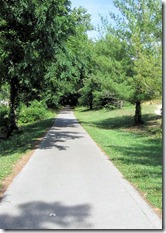
The Cadiz Railroad Trail runs for 2.5 miles between an old railroad depot on state Highway 139 and Fortner Drive at the east end of town. The trail parallels Noel Drive and Lafayette Street, following an old corridor of the Cadiz Railroad. The surface is asphalt, and it is used for hiking, jogging, bicycling, rollerblading, and skateboarding. A good five-mile hike can be obtained by walking the trail in both directions. Most of the trail passes through  neighborhoods; however, the east section is surrounded by a small stretch of farmland, and the western part passes through a secluded tunnel of trees and follows a deep ravine.

Cadiz Rail Trail 051The Cadiz Railroad Trail does not offer tall mountains, massive bluffs or the seclusion of a lush forest; however, you will come away from a long hike feeling relaxed and like you achieved a good workout. Midway through your walk you may wish to check out the local sights and culture of downtown Cadiz, or perhaps browse through one of the numerous antique shops. While walking on the trail, please be respectful of the many trailside homes and businesses; and remember to “take only pictures” and “leave only footprints.”
Saturday, September 15, 2012

Kuttawa Nature Trail

Capture Kuttawa is a Shawnee word meaning “beautiful,” and upon visiting one can easily see how the area inspired its name. The original town site was established by Charles Anderson, who was once the Governor of Ohio; and a man influential in constructing the Elizabethtown and Paducah Railroad, which is now the Louisville division of the Illinois Central Railroad. Anderson was also a strong supporter of African-American rights. Kuttawa became a widely known resort town and served religious, political and social functions until its demise upon the construction of Lake Barkley.

 Vista Ridge Trail 010On a blog site called “Genealogy, Middle Age and Life,” the beginning of Kuttawa is stated as follows: “One mile northwest of Kuttawa there was a cluster of five mineral springs within five hundred feet of each other. At this spot, there was a beautiful valley on the east side of Knob Creek, and on the west side a gently sloping hillside. This was an ideal place for a resort. A group of businessmen formed the Kuttawa Springs Corporation. A hotel was constructed in 1909 and people came from far and near to relax in the shade and drink and bathe in the mineral waters.”

The website “Land Between the Lakes Guide” states, “There are many trails throughout the area designed for you to take advantage of the stupendous scenery and the wideVista Ridge Trail 044 variety of wildlife. Hiking is a particularly good way of seeing the beauty of this area, and if you head to the northern end of Lake Barkley and the town of Kuttawa you’ll find some great trails, as well as being able  to enjoy the attractions of the town and its immediate area. The trails around Kuttawa are ideal for everyone; whether you’re a seasoned walker or just an enthusiastic ambler.”

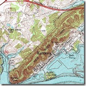
There is a well-groomed nature path in Kuttawa that runs the entire length of “Vista Ridge.” This landform is one of the tallest ridges found along the shore of Lake Barkley, rising nearly two hundred feet in elevation from base to summit, offering unparalleled views of the lake and surrounding region. A plaque located at each trailhead calls this the “Vista Ridge Park Walking and Bicycle Trail.” There is also an inscription on this plaque with the city of Kuttawa offering thanks to the Kentucky Transportation Cabinet and the Kuttawa Relocation Foundation for their financial  assistance.

Vista Ridge Trail 026The Vista Ridge Park Walking and Bicycle Trail is also known as the “Kuttawa Nature Trail.” The website “Land Between the Lakes Guide” provides the following description: “The Kuttawa Nature Trail starts on Lake Barkley Drive in old Kuttawa just across from the public boat ramp, and continues for [two] peaceful miles through the mountains. This trail is a chance to see a huge variety of trees, maybe up to forty different species, and also nesting warblers, vireos and wild turkeys; and if you’re lucky you’ll see Canadian geese and deer.”

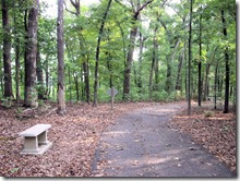
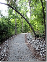
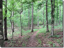
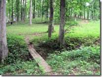
The Kuttawa Nature Trail offers hikers the chance to climb one of the Vista Ridge Trail 063tallest ridges in the surrounding area overlooking Lake Barkley, and  to encounter panoramic lake views and tranquil woods. Afterward, you may wish to check out historic Kuttawa. You will find this town to be very beautiful with a marina and harbour-side restaurant, and a sandy public beach with bathrooms, grills and picnic tables. You will come away from a day of hiking and sightseeing in Kuttawa feeling very relaxed. Please be respectful of the natural beauty and wildlife as you visit this public park and hiking trail, and remember to “take only pictures” and “leave only footprints.”
Friday, September 14, 2012

Energy Lake Trails

Capture Information on Energy Lake is somewhat scarce; however, I have discovered one author who has written somewhat extensively on the area, and his name is Johnny Molloy. I will be drawing a great deal of information from his book entitled Land Between the Lakes Outdoor Recreation Handbook, as I write this overview and brief description of the Energy Lake Campground and trail system.

Energy Lake is a quiet 370 acre inlet separated from Lake Barkley by Energy Dam, and it lies near the former community of Boardinghouse Hollow. Molloy elaborates on the vicinity near Energy Lake, saying, “Many residents lived in what was known as ‘Between the Rivers’ long before the Tennessee and Cumberland were dammed, long before TVA purchased the land, and long before the U. S. Forest Service came to Energy Lake Hike 060manage this recreation area.  Roads were poor and stores were few. Residents often bought goods from men who drove trucks and made the rounds of these forgotten hollows, selling everything from perfume to hoes” (Land Between the Lakes, p. 70).

Energy Lake Campground features an archery range, orienteering course, campfire theater, basketball court, playground, and canoe and kayak rentals. Boat access to Energy Lake and nearby Lake Barkley is from a boat ramp just outside the campground. Some campsites enjoy a scenic view of Energy Lake. All sites are tucked in among hickory, oak, sweet gum, sycamore, popular, and maple trees. The abundance of water, fish, and trees also attract a wide variety of bird life including herons and bald eagles.

Energy Lake Hike 064Energy Lake Campground contains its own trail system. Johnny Molloy, in another book called The Best in Tent Camping, says, “Two loop trails totaling more than six miles can be accessed right from your campsite. They wind and roll all over this hilly country” (p. 24). He also states, “A figure-eight double loop trail emanates from Energy Lake Campground. These trails are most often used by campers at Energy Lake, but are not exclusively for their use. The trails are hilly, but the vertical variation adds an exercise component to the attractive scenery of the lower Crooked Creek Valley” (Land Between the Lakes, p. 70).

Molloy continues to describe, “This is a good trail. It makes for a challenging hike as the path winds through remote hills, alongside  Crooked Creek Bay, then Shaw Branch Bay, and back to Energy Lake Campground with the help of the Connector Trail. Being little used, the trail tread is not developed, making it hard to follow at times, although the path is well blazed” (Land Between the Lakes, p. 70).

Energy Lake Hike 002The trails at Energy Lake Campground do not offer tall mountains, massive bluffs or intriguing rock formations; however, you will encounter picturesque lake views and peaceful woods. You will come away from a day of hiking and sightseeing feeling accomplished and relaxed; and the best part is that the hiking is absolutely free. Please be respectful of the natural beauty and wildlife as you visit this national recreation area, and remember to “take only pictures” and “leave only footprints.”
Lake Barkley State Park

Capture On December 1, 1964, the Kentucky State Parks system approved Lake Barkley State Resort Park; which is named for United States congressman, senator and vice president, Alban Barkley (1877-1956). The secretary of the Army approved the leasing of 1,800 acres of land along the shores of Lake Barkley for a public park and recreation facility. The state purchased 1,400 acres of surrounding land for a total of 3,200 acres. In the spring of 1966 the Economic Development Administration approved the Lake Barkley State Resort Park project to complete the most elaborate and largest state park in Kentucky.

Barkley and Carmindy B-Day 041 Lake Barkley State Resort Park presently sits on 186,000 acres of land, offering amenities such as an airport, contemporary resort lodge, state of the art fitness center, indoor and outdoor swimming pools, public beach and camping. Activities include boating, fishing, swimming, horseback riding, mountain biking, trap shooting, golfing on the 18-hole Boots Randolph Golf Course, and hiking on nearly seven miles of developed trails.

Lake Barkley Hike 003Hiking Trails at Lake Barkley include Lena Madesin Phillips Trail (0.6 miles), Wilderness Trail (2.8 miles),   Wagon Wheel Trail (0.3 miles), Cedar Grove Trail (1.7 miles), Blue Springs Trail (1.3 miles), Fitness Center Trail (0.08 miles), Racer Ridge Trail (1.2 miles), and Stable Trail (1.6 miles). Stable Trail is the widest and most well-groomed trail, as it is used for equestrian trail rides. Trail rides run from Memorial Day through Labor Day; and during the summer months you are only allowed to hike Stable Trail before 9:00 a.m. All trails are maintained by Friends of Lake Barkley.

Lake Barkley State Resort Park does not offer tall mountains or massive bluffs; though you may find the occasional limestone outcropping or large boulder. However, you will encounter picturesque lake views, peaceful woods, and rolling knobs and ridges. You will come away from a long day of hiking feeling accomplished and relaxed. A walk through the woods at Lake Barkley does the soul a world of good, and is a great stress reliever. Please be respectful of the natural beauty and wildlife as you visit this state resort park, and remember to “take only pictures” and “leave only footprints.”
Thursday, September 13, 2012

Woodlands Nature Station

Woodlands NS Woodlands Nature Station occupies land where the community of Hematite formerly stood. The area was settled with the construction of Center Furnace in 1852, which was built by Daniel Hillman. The furnace operated in three episodes: from 1852 through the Civil War; again in 1879-1883; and finally from 1905-1912. Once the iron production ceased, the town fizzled, and people began moving away. In 1963 this area became part of the Land Between the Lakes; designated as a national recreation area by President John F. Kennedy, and presently managed by the U. S. Forest Service.

Nature Station Trails 045 Woodlands Nature Station is a great place for a family outing. Exhibits encourage the exploration of native plants, reptiles and amphibians, and other mysteries of the outdoors. The backyard area of the “Nature Station” features wildlife native to the region. The live animal exhibits contain non-releasable animals that were orphaned, injured, or born in captivity. The area also demonstrates gardens, feeding stations, ponds, and shelters that you can use to make your own backyard more attractive and appealing to wildlife. There is a nominal entry fee for the wildlife exhibits. Nature Station Trails 050

Woodlands Nature Station is a popular hiking destination in the Land Between the Lakes, having around  seven miles of trails. Honker Trail (4.5 miles) winds around Honker Lake through a dense forest, meadows, and along the lakeshore. It is named for the resident flock of Canadian Geese. Hematite Lake Trail (2.2 miles), which circles Hematite Lake, offers a chance to see waterfowl, wetlands, and beaver. Woodland Walk (1 mile) is a wooded trail winding around the “Nature Station” through the forests and along the shoreline of Honker Lake. Center Furnace Trail (0.3 miles) is an easy walk with interpretive signs, offering a glimpse of the iron industry that once thrived in the region.

Nature Center Fall 041 Woodlands Nature Station does not offer tall mountains, massive bluffs or intriguing rock formations; however, you will encounter picturesque lake views, peaceful woods, long boardwalks through wetlands, beaver lodges, and traces of a bygone era in the early iron industry. You will come away from a long day of hiking and sightseeing feeling accomplished and relaxed; and the best part is that the hiking is absolutely free. Please be respectful of the natural beauty and wildlife as you visit this national recreation area, and remember to “take only pictures” and “leave only footprints.”
Wednesday, September 5, 2012

Pennyrile Nature Trail

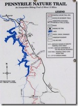
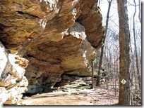
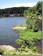
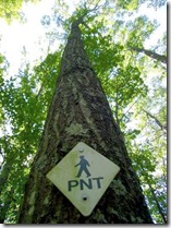
Jones Keeney Tradewater 107 The Pennyrile Nature Trail (PNT) stretches from a parking area south of Dawson Springs on Highway 109, all the way to Pennyrile State Resort Park where it combines with the Indian Bluff Trail to terminate at the state park lodge. The website “All about Paducah” describes the PNT as follows: “Enjoy scenic overlooks, abundant wildlife, and views from the bluffs of the Tradewater River as you meander along this 13.5 mile trail.” Along this hike, you will also encounter beautiful views of Lake Beshear.

In the book Hiking Kentucky, Michael H. Brown provides a brief history of this hiking trail, stating, “In the late 1990’s, doing much of the work on his own time, state forester Richard Hane set about to develop a hiking trail through the Pennyrile and Pilot Rock 017northern half of the 14,468 acre Pennyrile State Forest, the second-largest forest owned by Kentucky.  The result is the beautiful and strenuous Pennyrile Nature Trail” (p. 334).

The website “All about Paducah” continues to state, “This hiking trail is managed as part of the natural environment. The trail was designed for foot traffic only to minimize soil erosion. Most of the trail is in a PNT1working forest that is managed for multiple uses such as wildlife, clean water and air, timber production, recreation, and aesthetics. Visitors must be prepared to meet and accept nature on its own terms. The trail is considered to be moderate in difficulty due to the slopes and time needed to walk it.”

The website “Pixel’s Travels,” in describing the Pennyrile Nature Trail, states, “Recently ‘Backpacker Magazine’ [May 2005, p. 117] rated this trail the most difficult hiking trail in Kentucky. The trail is slightly difficult because it is d7needlessly twisty and little-used in parts, but it has none of the steepness, rocky surface, and remoteness found in eastern Kentucky trails.”

Should you require further information about the Pennyrile Nature Trail, the best contact person is Rebecca Clark; as she is known to lead annual guided hikes along the trail. She is the park Naturalist and Recreation Supervisor for Pennyrile State Resort Park. Please be respectful of the unique geologic features and natural resources as you hike through the Pennyrile State Forest, and remember to “take only pictures” and “leave only footprints.”
Tuesday, September 4, 2012

Lake Malone State Park

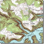
MALONE Topo Lake Malone State Park is located near Dunmor in Muhlenberg County on Highway 973, off of Highway 431, twenty-two miles south of the Central City / Drakesboro exit from the Western Kentucky Parkway. Lake Malone is considered to be one of the most beautiful lakes in the commonwealth. There are striking views of sandstone cliffs, such as Bear Bluff and Chalk Bluff, rising high above the water; and the park is also said to have a natural rock bridge located somewhere on the premises.

On December 22, 1955, at a meeting of representatives of Lake Malone promoters, Department of Fish and Lake Malone State Park 052 Wildlife, and the Federal Soil Conservation Service agreed to work together in planning a dam on Rocky Creek. Originally called the Rocky Creek Lake project, the dam would provide flood control for the Mud river watershed. The resulting lake and surrounding area would be used for recreation. In 1961, with the completion of the dam, the waters of Rocky Creek formed an 826-acre lake.

As early as 1959, several citizens wanted a state park in the area. The Muhlenberg Conservation Club that owned some of the land surrounding the lake donated their acreage to the park site. W. C. Malone, aLake Malone State Park 044 wealthy, retired lumberman and sawmill operator from Greenville, along with his wife, donated a  large amount of land for the development of the lake and state park; therefore, the lake and subsequent state park were named in his honor.

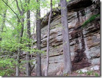
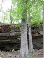
The Kentucky State Parks website encourages, “Hike through the forest thick with hardwood trees, holly, mountain laurel, and tall pines.” The website also advertises, “Discover the beautiful landscape of Lake Malone State Park on the 1.5-mile Laurel Trail or the 0.25-mile Wildflower Trail. These easy-rated hiking trails provide picturesque views of many rock walls, once used as shelters by Native Americans . . . Natural wonders abound in this secluded wilderness!”

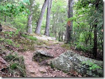
Lake Malone State Park 084Lake Malone State Park is a great place for a picnic and a casual hike, but don’t come expecting to rack up  mileage, since the main trail is just over a mile in length. This state park presents a hike for those who love to observe unique rock formations; however, the trail only follows the cliffs for about one-third a mile, before ascending a stairway to the grassy fields above. I found it a disappointment that the stretch of bluffs was so short. Please be respectful of the natural features as you visit this state park, and remember to “take only pictures” and “leave only footprints.”
Monday, September 3, 2012

Pennyrile State Park

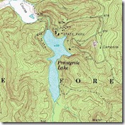
TOPO Pennyrile On July 9, 1954, Pennyrile State Resort Park became included in the state parks system. In the 2005 “Master Tourism Plan” of the Dawson Springs Economic Development Group, it is stated that “Pennyrile Forest and the State Resort Park are commonly referred to as the ‘best kept secrets’ in western Kentucky. While the Kentucky Parks System produces marketing materials and videos to promote the area, it remains underutilized due to a lack of focus in marketing efforts.”

The Kentucky States Parks website notes that this location “is surrounded by perhaps the most beautiful woods in western Kentucky,” and that “the park is the perfect back-to-nature hideaway in the midst of a secluded, lush Indian Bluffs forest.” Pennyrile State Resort Park is named for the tiny “pennyroyal plant” found in the region, used medicinally by the early settlers, and commonly called “pennyrile” by the locals.

In the book Hiking Kentucky, Brook Elliot states, “The area now occupied by the park was settled in 1808, when John Thompson, the first settler traveled here looking for wild game. He took up residence in a fair-sized rock shelter, which can still be visited. Within a few years, a thriving community grew called Concord. Numerous remains of the settlement and human occupation can be found in the park and surrounding state forest” (p. 189).

In the 1930’s the National Park Service and the Works Progress Administration (WPA) developed a 300 acre tract for 70220572 recreational purposes. The WPA continued its work in the area until 1937 when the Kentucky Division of State Parks took responsibility for the land on an annual agreement basis. The state constructed a rustic lodge for visitors and made a number of improvements to the site. This continued until 1954 when the Kentucky Parks System took final oversight of the Pennyrile site.

There are about five miles of hiking trails located within the state park boundary; trails such as Lake Trail, Indian Bluff Trail, Pennyroyal Trail, Cane Trail, Clifty Creek Trail and Thompson’s Hollow Trail. There is also a short section of the Pennyrile Nature Trail, which begins on Indian Bluff Trail and continues 13.5 miles to the nearby town of Dawson Springs. Should you require further trail information, the best person to contact is Rebecca Clark, the park Naturalist  and Recreation Supervisor.

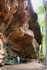
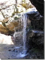
70220549While hiking through Pennyrile State Resort Park one will encounter tall bluffs, rock shelters, a waterfall, unique rock formations, stair steps carved straight from the sandstone, and magnificent lake views. Please be respectful of the natural features as you visit this state park, and remember to “take only pictures” and “leave only footprints.” Also, be certain to tell others about this amazing state park. Increased tourism dollars should lead to better trail maintenance and development.

Mantle Rock Preserve

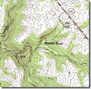
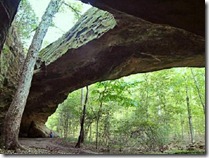
TOPO Mantle In northwestern Livingston County lies Mantle Rock; a natural curiosity reminiscent of rock features one might find in the Daniel Boone National Forest of eastern Kentucky. Mantle Rock is the largest freestanding arch east of the Mississippi River, at 180 feet long and 30 feet high. It is located near the community of Joy, Kentucky on the 367 acre Mantle Rock Preserve, which is a joint project of the Nature Conservancy and the National Park Service. Numerous bluffs, shelters, and honeycomb formations embellish this area, which is also known for its extensive faulting and abundant fluorite deposits.

The Nature Conservancy website states, “Mantle Rock has historic significance, serving as a certified site on Mantle Rock the Trail of Tears National Historic Trail. The location is a reminder of the harsh winter of 1838-1839 when the Cherokee Nation was forced to give up its lands east of the Mississippi River and migrate to an area in present-day Oklahoma. During this time, approximately 1,766 persons from the Peter Hildebrand Detachment were forced to spend about two weeks in the Mantle Rock area while waiting for the Ohio River to thaw and become passable.”

Some stories tell that the Cherokee camped under Mantle Rock. Other stories suggest that there were burials underneath the Rock; however, there is no proof to support these claims. Nevertheless, manyMantle Rock and Art Show 048  Cherokees return each year to pay homage to their ancestors on the Trail of Tears. There is also a Mantle Rock Native Education and Cultural Center located in the nearby town of Marion, Kentucky.

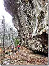
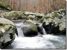
There is an approximately 2.75 mile easy rated loop trail on the preserve. The trail takes the casual hiker on a small portion of the Trail of Tears before veering southward toward the Mantle Rock natural arch. From there, the trail follows a towering bluff line, leading past waterfalls and numerous rock shelters. The trail eventually descends to a rolling stream cascading over huge boulders, reminding one of a sight found in the Smoky Mountains of Tennessee. From the stream, the trail circles back around, picking up the Trail of Tears and eventually leading back to the starting area.

Mantle Rock 074 The parking area for the Mantle Rock Preserve is located 2.1 miles west of the community of Joy, Kentucky on Highway 133. Unique rock formations and Native American history await visitors of Mantle Rock. While in the area, be sure to visit Joy Falls, located on the left side of the highway a half mile west of the Mantle Rock Preserve. This secluded site with its serene beauty, sandstone outcroppings, and waterfall makes a great photo opportunity; not to mention a good swimming hole. When visiting these sites, please remember to “take only pictures” and “leave only footprints.”
Sunday, September 2, 2012

Jones-Keeney WMA

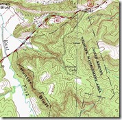
Hunter Bluff Topo “Back in 1931, two far-sighted men worked together to purchase the first wildlife management area for the people of Kentucky. Their names were Dr. Joe W. Jones and Dr. B. L. Keeney, and they were both members of the old five-person Game and Fish Commission. At the January 1931 meeting, Jones invited the Commission to visit a site near Dawson Springs, which he proposed buying for use as a game refuge. By March, commissioners decided to acquire the property and name it the Jones-Keeney Game Refuge. The area is now called the Jones-Keeney Wildlife Management Area” (Kentucky Afield, 2002).

In the early 1900’s the nearby city of Dawson Springs once thrived with numerous mineral resorts and spas, and   people came from all over the United States to soak in the healing waters. When people weren’t taking advantage of the natural springs and cultural amenities, they were out hiking the surrounding countryside. One highly visited natural wonder was the Dawson Cliffs, which is a prominent feature found on the property of the Jones-Keeney WMA.

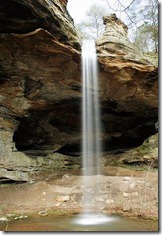
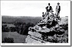
In the book Hopkins County, Lisa D. Piper states, “The Dawson Cliffs became the place where hikers chiseled out their name and the date of their visit on the rocks. It was around this area that sights like Point Lookout, Counterfeiter’s Cave, and Bandit’s Cave were found” (p. 92). Many of these notable landmarks have been forever preserved in old postcards from the era, including what the locals call Saltpeter Cave. This massive rock shelter, along with its beautiful waterfall, can be accessed by hiking the trail leading southwest away from the second gravel parking lot on the right.

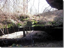
Waterfall2In the springtime the fields surrounding the trail to Saltpeter Cave are strewn with daffodils, leading the locals to call this area “Buttercup Hill.” In the vicinity of Buttercup Hill lies a rare rock formation called a waterfall natural bridge; and there is actually a small waterfall directly behind it, which creates a stream that flows beneath the structure. There is no marked trail leading to the natural bridge; and since there is presently no graffiti at this site, I hope to keep it that way by not specifying its exact location. The whereabouts of this natural feature will be left to the avid explorer.

The history of the Jones-Keeney WMA predates the Dawson Cliff explorers of the early 1900’s. Dawson Springs was originally named Tradewater Station. In the 2005 “Master Tourism Plan” of the Dawson Springs Economic Development Group, it is stated that Native Americans once used the present day Dawson Springs site, located along  the Tradewater River, as a place for trading; and that there is a two hundred seventy acre Native American site located near the Jones-Keeney WMA. 70217316Therefore, Native Americans likely enjoyed exploring the cliffs and natural features as well.

Beautiful scenery and unique rock formations await visitors of the Jones-Keeney WMA. Please be careful, as there are high cliffs that create a falling hazard. Saltpeter Cave contains graffiti, litter, and rock climbing bolts. Please do not contribute to the degradation of this natural wonder. Remember to “take only pictures” and “leave only footprints.” Respect and conservation of this site should contribute to keeping its access open to the public for generations to come.
Saturday, September 1, 2012

Hunters Bluff Preserve

Hunter Bluff Topo Hunters Bluff comprises what was once called the Dawson Cliffs. In the early 1900’s the nearby city of Dawson Springs once thrived with numerous mineral resorts and spas, and people came from all over the United States to soak in the healing waters. When people weren’t taking advantage of the natural springs and cultural amenities, they were out hiking the surrounding countryside.

In the book Hopkins County, Lisa D. Piper states, “The resort town of Dawson Springs had plenty of outdoor activities . . . There were many cliffs and bluffs to explore, and people hiked the trails, visiting rock formations, nooks, and lookout areas” (p. 93). She also notes, “The Dawson Cliffs became the place where hikers chiseled  out their name and the date of their visit on the rocks. It was around this Dawson3area that sights like Point Lookout, Counterfeiter’s Cave, and Bandit’s Cave were found” (p. 92). These notable landmarks have been forever preserved in old postcards from the era.

Thankfully, many of these legendary hiking sites are now open to the public due to generous donations from the former land owners. The top of Hunters Bluff, where Point Lookout is located, now lies on the property of the Jones-Keeney Wildlife Management Area, owned and operated by the Kentucky Department of Fish and Wildlife. The base of the Bluff now lies on the property of the Nature Conservancy, which accepted this tract of land as a donation from Kenneth Oldham in 1992.

Hunters Bluff holds an abundance of curiosities for the nature lover. The Nature Conservancy website describes the location as follows: “This preserve protects a small tract of old growth forest and a population of rare bugbane.” “The cliff tops support an unusually dry forest for the region with much Virginia pine. The bottomland includes swampy areas as well as an unusual second-growth forest including plants such as ginseng, goldenseal, glade knotweed, and rushfoil.”

To access Point Lookout located at the top of Hunters Bluff, travel three miles west of Dawson Springs on U.S. Highway 62, and look for the gravel road and Jones-Keeney WMA sign on the left. Follow this gravel road to the first gravel parking area on the right, and then hike the trail west to the top of the cliff where you will recognize Point Lookout and take in breathtaking and unparalleled views.

Jones Keeney Tradewater 012 To access the base of Hunters Bluff travel four and one-half miles west of Dawson Springs on U.S. Highway 62, first passing the Jones-Keeney WMA sign on the left, and then descending a hill and passing the shooting range on the left; and then you will park at the small gravel pull-off located on the left side of the highway just before crossing the bridge. From the parking area you will hike a dirt road south to the base of the Bluff where you can observe one hundred fifty foot tall cliffs and boulders as large as houses strewn across the ground.

Access to the base is limited. The Nature Conservancy website Jones Keeney Tradewater 046states, “Due to the sensitivity of the site, the preserve is open to the public only through Conservancy guided hikes.” Therefore, hike at your own discretion; or contact the Nature Conservancy at 642 West Main Street, Lexington, KY 40408, Phone: (859) 259-9655.

Magnificent vistas and unique rock formations await visitors of Hunters Bluff. Please be careful, as many people have fallen from the high cliffs and been killed. The base of the Bluff contains graffiti, litter, and rock climbing bolts. Please do not contribute to the degradation of this natural and historic site. Remember to “take only pictures” and “leave only footprints.” Respect and conservation of this site should contribute to keeping its access open to the public for generations to come.